Wednesday, October 16, 2002
Black Mesa State Park, Kenton, OK - Oct 15-16
This is a very pleasant, if somewhat out-of-the-way, park with 34 RV sites and numerous tent sites. We were dry-camping, so we just set up in the picnic area. Black Mesa SP is named for the 45-mile long feature formed from a thick layer of black lava rock that stretches along the Colorado/New Mexico border into the panhandle of Oklahoma. Curiously, none of the mesa is actually in the park.
 When planning our sightseeing loop drive for our one full day here, we were surprised by how much there was to see. Nearby is Black Mesa Nature Preserve, which features OK's highest point, at 4973 ft above sea level. We did not view the actual granite marker, as it was at the end of a steep, 4.2-mile trail. We did drive to the Carrizo Canyon Picnic Area, where the east fork of Carrizo Creek flows through this small canyon graced by juniper and cottonwoods, all in the fall foliage. Most interesting, there were petroglyphs found along the canyon wall -- quite a pleasant surprise, as we're always on the lookout for Native American rock art.
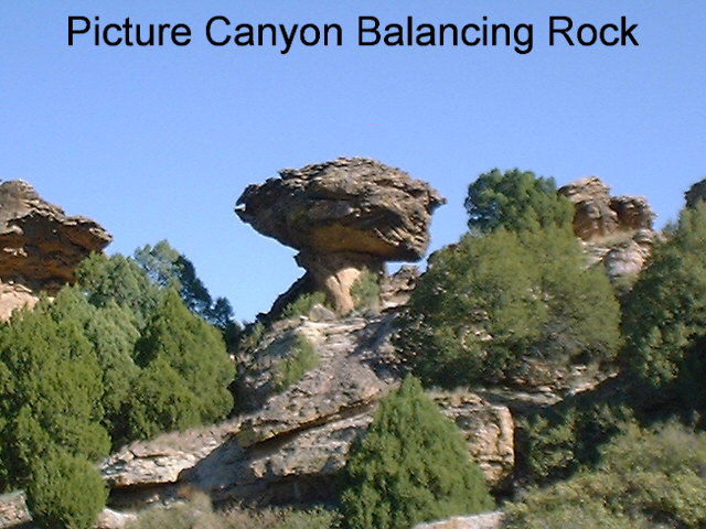
 Our next stop was Picture Canyon, named not for the fact that it is picturesque (and it is!), but by the abundance of rock art here, both petroglyphs and pictographs. Unfortunately, almost all of the petroglyphs we saw were defaced or vandalized, a sad reminder that these treasures are irreplaceable; through one thoughtless act they can be lost forever. Some still survive, however, and may have had astronomical significance -- public tours are offered here during the Fall equinox. Both of these archeological sites are located in the Comanche Natl Grasslands in southern CO.
 When planning our sightseeing loop drive for our one full day here, we were surprised by how much there was to see. Nearby is Black Mesa Nature Preserve, which features OK's highest point, at 4973 ft above sea level. We did not view the actual granite marker, as it was at the end of a steep, 4.2-mile trail. We did drive to the Carrizo Canyon Picnic Area, where the east fork of Carrizo Creek flows through this small canyon graced by juniper and cottonwoods, all in the fall foliage. Most interesting, there were petroglyphs found along the canyon wall -- quite a pleasant surprise, as we're always on the lookout for Native American rock art.
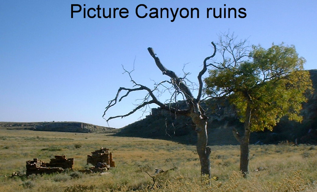 Our next stop was Picture Canyon, named not for the fact that it is picturesque (and it is!), but by the abundance of rock art here, both petroglyphs and pictographs. Unfortunately, almost all of the petroglyphs we saw were defaced or vandalized, a sad reminder that these treasures are irreplaceable; through one thoughtless act they can be lost forever. Some still survive, however, and may have had astronomical significance -- public tours are offered here during the Fall equinox. Both of these archeological sites are located in the Comanche Natl Grasslands in southern CO.
# posted by Doug and Willie @ 7:17 PM 
![]()